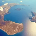
What would happen if Santorini island causes a tsunami in Greece the Aegean? Turkish experts are studying how a volcanic eruption on the Greek island of Santorini or a major earthquake triggering a tsunami wave would affect the region and west coast of Turkey: something that no-one can rule out at the moment and which, according to some Turkish scientists, could reach a height of up to 20 metres, penetrating in some areas up to 60 km inland.
In statements reported by Turkish media, Orhan Tatar, general director of Earthquake and Risk Prevention at the Turkish Disaster and Emergency Management Agency (AFAD), confirmed that there is a risk that the wave of earthquakes in Santorini could trigger a volcanic eruption or even a tsunami that would reach the Turkish coast, although he said that ’we predict that the tsunami would not have a devastating effect if it reaches our coast’.
Tatar, who made these statements after attending a meeting of experts in Izmir a few days ago to analyse the scenarios in the event of an eruption in Santorini, explained that the risk of a tsunami on the Turkish Aegean coast decreases as we move ‘from south to north’, and that it would take at least an hour for the waves to reach the coasts of Muğla, Bodrum and Datça, located opposite the Greek island. ‘As we move north towards Izmir, the effect of the tsunami would diminish and even be insignificant,’ he said.
‘Our tsunami models include multiple scenarios, they help us to refine our predictions and preparations,’ the expert emphasised. With regard to the possibility of an eruption of the Santorini volcano, Tatar said that several teams are already working for AFAD carrying out daily analyses of atmospheric conditions at different altitudes to predict the movement of volcanic ash in the event of an eruption.
The tsunami would reach a height of 20 metres and penetrate 60 km
In other statements made to the Turkish news agency DHA, Professor Ceyhun Özçelik of Sıtkı Koçman University in Muğla was less optimistic and, after carrying out simulations on the areas at risk of flooding in the event of a tsunami caused by the earthquakes in the Aegean, stated that ’the areas at risk of flooding cover a very large area in Izmir, Kuşadası and the Gulf of Güllük (between Bodrum and Kuşadası), although given that Izmir is located in an inland gulf and the coast is protected by islands, the risk of a tsunami in this area is low’.
‘The greatest risk is south of Bodrum and in Datça. The Greek islands of Crete and Rhodes, and the Morea peninsula (Greece), are the regions that would be most exposed to the effects of the tsunami,’ explained Özçelik, adding that both Turkey and Greece would be in danger. ‘After the earthquakes of 6 February 2023, there were floods along the coasts of İskenderun (Alexandretta) for weeks, and also along the coast of Köyceğiz in Muğla, in the Gulf of Izmir, and in various parts of the Aegean and the Mediterranean,’ said the Turkish expert.

‘We have determined that the areas at risk of marine flooding reach 5, 10 and 20 metres (in height). To do this, we have used data from the Advanced Land Observing Satellite ALOS,’ explained Özçelik, showing the maps created with the flood risk zones in case of a tsunami. “There are many wetlands along the Turkish coast, and these wetlands and cities are at low altitude and the risk of flooding is high,” he warned.

‘If we analyse the Aegean coast, starting from Foça, Bayraklı, Izmir and around the Urla peninsula, the 10 and 20 metre risk zones cover large areas. Kuşadası, the Gulf of Latmos, opposite the island of Samos, Didim, the Gulf of Güllük, Gümüşlük, Turgutreis, Bodrum, Akyaka, Ören, Turgut, Marmaris, Köyceğiz, Sarıgerme and Fethiye are in the area at risk of a sea flood of 5 and 10 metres,’ said the expert.
According to the models shown, and in the worst-case scenario, in areas such as the Gulf of Güllük a tsunami – triggered by a major earthquake or an eruption on Santorini – reaching 20 metres in height, would penetrate up to 60 km inland in the province of Aydin, also severely affecting the coasts of Dalaman, Selçuk and the city of Izmir, penetrating the sea between 30 and 40 km in these areas.
VOTE

EDITORIAL TEAM
🧿 About us
.
Edited and reviewed by:

Pablo Gómez is a specialist in Turkey and has been editor-in-chief of Hispanatolia since 2011. He has been analysing current affairs and geopolitics in Turkey and the surrounding region since 2006.
…
📣 Your ADVERTISING on Hispanatolia
.
🤗 HELP US WITH A DONATION:
💗 Paypal