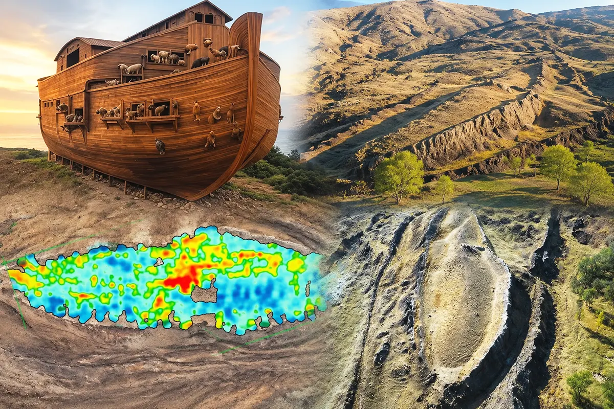
An international team studying the Durupınar formation, situated near Mount Ararat (Ağrı Dağı in Turkish) in eastern Turkey, claims that the region’s famous boat-shaped structure may not simply be a rock formation, as many scientists believe, but could in fact be the remains of Noah’s Ark.
Using a specialised radar system, the researchers have detected various layers and subsurface anomalies, thereby reigniting a decades-long controversy about where Noah’s Ark is, whether it actually existed, and whether its remains lie in Anatolia.
New findings beneath the Durupınar formation
Situated 29 kilometres south of Mount Ararat – Turkey’s highest peak at 5,137 metres – the so-called Durupınar formation has been at the centre of research into the Ark of Noah for decades due to its distinctive ship-like shape. Andrew Jones, an American researcher and founder of Noah’s Ark Scans, claimed as early as 2024 – after analysing a total of 88 soil samples collected in the area – that the geological formation could in fact be Noah’s Ark.
Most scientists consider Durupınar to be a geological structure formed by natural processes. However, the debate over the origin of this curious formation has now attracted the attention of the Iranian-born scientist Khosrow Bakhtar, an expert in geomechanics, electromagnetism and subsurface radar technologies, who has suggested that the formation may not be solely a natural rock structure, as many believe.
According to a report in the British newspaper Daily Mail, which has been picked up by numerous media outlets in Türkiye, including the CNN Türk news network, the team led by Bakhtar used a BakhtarRadar in its study – a specialised subsurface exploration system developed from research by the United States Air Force – to analyse the depths of the strange formation located at the foot of Mount Ararat.
The new research led by Bakhtar employed this radar system to identify layers and anomalies deep within Durupınar, as this electromagnetic technology enables the generation of three-dimensional images of underground structures without physically excavating the ground. The team claims to have obtained significant digital data from the area.
The results of the study challenge the scientific theory accepted until now
Apparently, the survey detected strong anomalies beneath the surface and distinct layers beneath the rock structure, which is approximately 157 metres long: findings that would challenge the scientific paradigm generally accepted until now, namely that the extrange formation consists of a single homogeneous mass of rock.
The researchers have pointed out that the data obtained could force a reconsideration of the idea, championed by numerous scientists, that Durupınar consists of a single homogeneous block of rock. However, they also acknowledge that the results are preliminary and that the anomalies detected by radar, on their own, do not prove an archaeological or human origin for the formation.
“My team and I are carefully evaluating the collected subsurface data, which aids in planning the core drilling pattern to be performed at the site. We will use BakhtarRadar’s unique capability to directly distinguish any still preserved petrified, man-worked timbers from the natural host formation and its varying mineralogy,” said Bakhtar.
The team hopes to publish a preliminary technical report in the coming weeks; this document will identify the most significant anomalies detected, provide a clearer picture of the geology beneath the surface, and also determine the best locations for specific test drilling, once they have obtained the necessary permits from the Turkish authorities.
A search linked to the biblical story of Noah
The Durupınar formation, situated less than 30 kilometres south of Mount Ararat, has been known to the modern world for almost a century. According to Turkish media reports, it was the heavy rains and earthquakes recorded in May 1948 that washed away the mud surrounding the area and uncovered the mysterious structure, which was subsequently discovered by a local shepherd, who was struck by its resemblance to a huge ship.
According to biblical and Christian tradition, the prophet Noah, together with several members of his family and a pair of every animal, survived the Great Flood that occurred approximately 4,300 years ago by sailing in a huge ark which he built, inspired by God, after He had warned him of the coming of a universal flood that would submerge the world. The Durupınar formation, due to its distinctive ship-like shape and its location at the foot of Mount Ararat, has for years attracted the attention of many researchers precisely because of the religious beliefs that place the famous ark at this site.
Although Christianity and Islam share the belief in the Flood and in the role of Noah (regarded by both religions as a prophet of God), among Muslims the account differs; thus, whilst Genesis describes a flood that covers the whole Earth and wipes out all living creatures except those on the ark, the Qur’an presents it as a punishment directed solely at the people of Noah, without stating that it flooded the whole world.
Furthermore, the Qur’anic account does not state that Noah took a pair of every existing animal species onto the ark, but rather that God commanded him to take “two pairs” of certain animals. Another key difference is the location where the ark came to rest after the waters receded: the Bible places it in the mountains of Ararat; but the Qur’an states that Noah’s Ark came to rest on Mount Cudi (Judi) – in Turkish Cudi Dağı – a well-known mountain situated in the Turkish province of Şırnak, on the border between Turkey, Syria and Iraq.
VOTE

EDITORIAL TEAM
🧿 About us
.
Edited and reviewed by:

Pablo Gómez is a specialist in Turkey and has been editor-in-chief of Hispanatolia since 2011. He has been analysing current affairs and geopolitics in Turkey and the surrounding region since 2006.
…
📣 Your ADVERTISING on Hispanatolia
.
🤗 HELP US WITH A DONATION:
💗 Paypal